 Picto-Occitanie
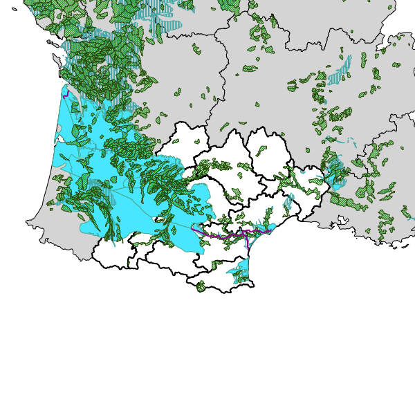
Visualiseur PSN nouvelle PAC 2023-2027 - masses d’eau en mauvais état quantitatif au titre de l’article 74
Cartographie dynamique des données PSN et de masses d’eau en mauvais état quantitatif au titre de l’article 74 du Plan Stratégique National de la nouvelle PAC 2023-2027. Bassin Adour-Garonne
Simple
Identification info
Contains Operations
- Operation Name
- Accès à la métadonnée de service WMS
- Distributed Computing Platforms
- Web services
- Date (Creation)
- 2025-04-28
- INSPIRE Service taxonomy
-
- infoMapAccessService
- Plateforme Occitanie - mots clés géo
-
- OCCITANIE
- GEMET - INSPIRE themes, version 1.0
-
- Zones de gestion, de restriction ou de réglementation et unités de déclaration
- Hydrographie
- Domaines
-
- N_MASSE_EAU
- DREAL
- SERVICES ETAT
- PSN_MASSES_EAUX
- Use limitation
- Utilisation libre sous réserve de mentionner la source (a minima le nom du producteur) et la date de sa dernière mise à jour
- Access constraints
- Other restrictions
- Other constraints
- Pas de restriction d’accès public selon INSPIRE
- Service Type
- invoke
- Description
- OCCITANIE
N
S
E
W
))
- Coupling Type
- Tight
Contains Operations
- Operation Name
- Accès à la carte
Contains Operations
- Operation Name
- Accès à la carte interactive
- Distributed Computing Platforms
- Web services
Contains Operations
- Operation Name
- Accès à la carte interactive
- Distributed Computing Platforms
- Web services
Contains Operations
- Operation Name
- Accès à la carte interactive
- Distributed Computing Platforms
- Web services
Contains Operations
- Operation Name
- Accès à la carte interactive
- Distributed Computing Platforms
- Web services
Contains Operations
- Operation Name
- Accès à la carte interactive
- Distributed Computing Platforms
- Web services
Contains Operations
- Operation Name
- Accès à la carte interactive
- Distributed Computing Platforms
- Web services
Contains Operations
- Operation Name
- Accès à la carte interactive
- Distributed Computing Platforms
- Web services
Contains Operations
- Operation Name
- Accès à la carte interactive
- Distributed Computing Platforms
- Web services
- Connect Point
- https://catalogue.picto-occitanie.fr/geosource/consultation?id=57295041 ( WWW:LINK-1.0-http--link )
Contains Operations
- Operation Name
- Accès à la carte interactive
- Distributed Computing Platforms
- Web services
- Connect Point
- https://catalogue.picto-occitanie.fr/geosource/consultation?id=57295041 ( WWW:LINK-1.0-http--link )
Coupled Resource
- Operation Name
- GetCapabilities
- Identifier
- 1a1adb74-538f-4e87-ac8e-c6d1cb87712b
Coupled Resource
- Operation Name
- GetCapabilities
- Identifier
- 391a2471-5c15-42e3-ab79-ebe055464bd1
Coupled Resource
- Operation Name
- GetCapabilities
- Identifier
- 9fd8fdfc-b3a7-4c44-adba-da10c895412f
Coupled Resource
- Operation Name
- GetCapabilities
- Identifier
- 05b58257-1ba0-4c6d-9025-25ea7ef67120
Coupled Resource
- Operation Name
- GetCapabilities
- Identifier
- 4cb74c78-f295-4d09-a5b2-438d0ff6fec3
Coupled Resource
- Operation Name
- GetCapabilities
- Identifier
- 5a49930e-ec83-454e-965f-0d713a136a80
Coupled Resource
- Operation Name
- GetCapabilities
- Identifier
- 1eb599ae-7260-438f-b679-b8bf543d0cc4
Coupled Resource
- Operation Name
- GetCapabilities
- Identifier
- 4058344b-93d4-455c-ad83-2ac2b1769654
- Operates On
-
- [AELB] Masses d'eau de surface - canaux PSN
- [AELB] Masses d'eau de surface PSN
- [DREAL OCCITANIE] Section cadastrales en Occitanie (PCI vecteur)
- [AELB] Masses d'eau souterraines PSN
- [DREAL OCCITANIE] Localisants de parcelles cadastrales en Occitanie (PCI vecteur)
- Régions de France - BD CARTO IGN
- Communes de la BD CARTO IGN - ADMIN EXPRESS en Occitanie
- Départements de la BD CARTO IGN en Occitanie
- Reference system identifier
- EPSG / RGF93 / Lambert-93 (EPSG:2154) / 7.9
- Units of distribution
- liens associés
- OnLine resource
-
Accès à la carte
(
WWW:LINK-1.0-http--link
)
Accès à la carte
- Hierarchy level
- Interactive map
Conformance result
- Date (Publication)
- 2016-12-16
- Pass
- Yes
- Statement
- Cartographie dynamique des données PSN et de masses d’eau en mauvais état quantitatif au titre de l’article 74 du Plan Stratégique National de la nouvelle PAC 2023-2027. Bassin Adour-Garonne
- File identifier
- 5c55aadd-4f68-46ab-99d4-b634d40c01cf XML
- Metadata language
- fre
- Character set
- UTF8
- Hierarchy level
- Service
- Hierarchy level name
- service
- Date stamp
- 2025-04-30T13:31:26
- Metadata standard name
- ISO 19115:2003/19139
- Metadata standard version
- 1.0
Overviews
Aperçu
Spatial extent
N
S
E
W
Provided by

Associated resources
Not available